University of Minnesota
http://www.umn.edu/
612-625-5000
http://www.umn.edu/
612-625-5000
Minnesota Biodiversity Atlas
Bell Museum
Dataset: MIN-Plants
Taxa: Dryopteris cristata
Search Criteria: excluding cultivated/captive occurrences
Bell Museum plants | |
 MIN:Plants | 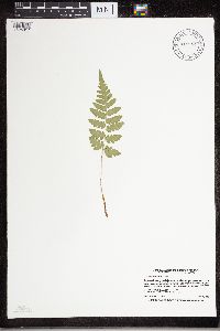 Dryopteris cristata (L.) A. Gray 915984[1324017]Smith, Welby 224901993-06-18 United States, Minnesota, Grant, Grant County...On the south side of Ask Lake, about 1.5 miles east-southest of Ashby...T 130N R 41W NW1/4 of SW1/4 of Sec 12. 130N 41W 12, 46.0847222 -95.7886111 |
MIN:Plants | 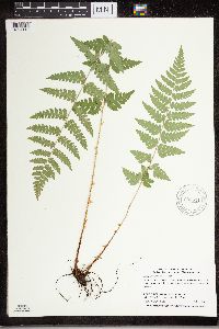 Dryopteris cristata (L.) A. Gray 906511[1324112]Smith, Welby 309622008-07-02 United States, Minnesota, Saint Louis, St. Louis County...About 18 miles E-SE of Gilbert, in Superior National Forest...T57N R14W SW1/4 of SW1/4 of Sec 34;Superior National Forest;057N;14W;34, 47.3744444 -92.1072222 |
MIN:Plants | 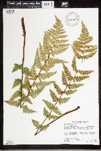 Dryopteris cristata (L.) A. Gray 917055[1324015]Gerdes, Lynden 58142009-07-24 United States, Minnesota, Cook, Boundary Waters Canoe Area Wilderness / Superior National Forest. T64N R05W S03NWSENWNE. Cook County, MN. Superior National Forest. Boundary Waters Canoe Area Wilderness. Northern shores bog pond between Gillis Lake and French Lake...NAD 83 / 653004/ 5325064. 064N 05W 3, 48.0605556 -90.9463889 |
MIN:Plants | 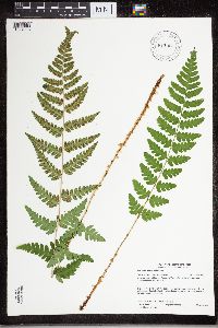 Dryopteris cristata (L.) A. Gray 917063[1324013]Gerdes, Lynden 58992009-08-25 United States, Minnesota, Cook, Boundary Waters Canoe Area Wilderness / Superior National Forest. T66N R05W S12 NWSESWNW Cook County ... Superior National Forest. Boundary Waters Canoe Area Wilderness. Saganaga Lake. Munker Island.. T066N R05W S12, 48.215119 -90.912522 |
MIN:Plants | 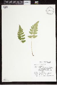 Dryopteris cristata (L.) A. Gray 489529[1324131]Smith, Michael 1481996-08-17 United States, Minnesota, Saint Louis, Voyageurs National Park. St. Louis Co.; Plot name: Voya 16 DNR # 5774; Hitchcock Bay/ 48 32'49" 92 54'46";Voyageurs National Park;070N;20W;, 48.5469437 -92.9127808 |
MIN:Plants | 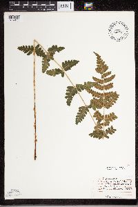 Dryopteris cristata (L.) A. Gray 474405[1324133]Moore, John 4501971-08-11 United States, Minnesota, Sherburne, NW/4 S - 13 Orrock Tshp.;Sherburne National Wildlife Refuge;034N;27W;13, 45.4333 -93.7333 |
MIN:Plants | 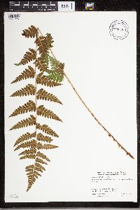 Dryopteris cristata (L.) A. Gray 904446[1324025]Smith, Welby 282451999-08-31 United States, Minnesota, Itasca, Itasca County...About 14 miles north of Nashwauk...T 55N R 22W SE1/4 of NW1/4 of Sec 20;George Washington State Forest;055N;22W;29, 47.585 -93.1527778 |
MIN:Plants | 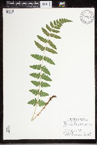 Dryopteris cristata (L.) A. Gray 915045[1324016]Smith, Welby 313752009-08-13 United States, Minnesota, Blue Earth, Cobb Wildlife Management Area. Blue Earth County ... Cobb Waterfowl Production Area, about 13 miles south of Mankato ... T106N R26W NW1/4 of NW1/4 of Sec 23. 106N 26W 23, 43.9758333 -93.9244444 |
MIN:Plants | 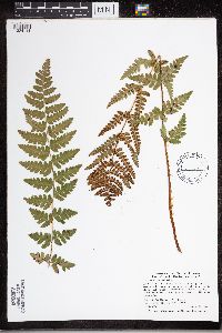 Dryopteris cristata (L.) A. Gray 438864[1324114]Wolff, Jan W11993-08-27 United States, Minnesota, Kanabec, Kanabec County ... Pomroy Lake ... T41N R22W NW1/4 of NW1/4 of Sec 19;;041N;22W;19, 46.0230556 -93.1769444 |
MIN:Plants | 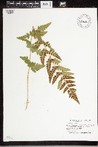 Dryopteris cristata (L.) A. Gray 914529[1324019]Smith, Welby 250991994-08-16 United States, Minnesota, Itasca, Scenic State Park. Itasca County...In Scenic State Park; about 9 miles south-southeast of Effie...T 60N R 25W SW1/4 of SW 1/4 of Sec 6. 60N 25W 6, 47.7027778 -93.5733333 |
MIN:Plants | 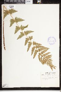 Dryopteris cristata (L.) A. Gray 375558[1324616]Tryon, R. 25601936-07-20 United States, Indiana, Porter, Indiana Dunes State Park, Porter Co.;Indiana Dunes National Lakeshore;;;, 39.960966 -86.330078 |
MIN:Plants | 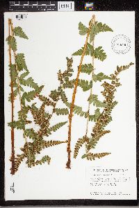 Dryopteris cristata (L.) A. Gray 896505[1324109]Smith, Welby 157661989-07-17 United States, Minnesota, Benton, Sartell Wildlife Management Area. Benton County ... Sartell State Wildlife Management Agea [sic], about 3 miles north-northeast of Rice ...NW1/4 NW1/4 section 15, T38N R 31W. 038N 31W 15, 45.7933333 -94.1947222 |
MIN:Plants | 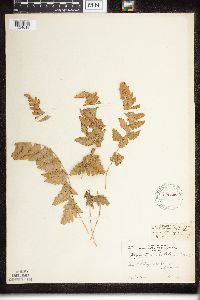 Dryopteris cristata (L.) A. Gray 220447[1324618]Cooper, William 2911910-09-01 United States, Michigan, Keweenaw, Near Old Camp, Siskowit, Isle Royale;Isle Royale National Park;;;, 48.010955 -88.828422 |
MIN:Plants | 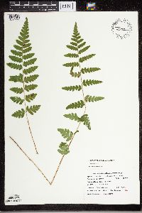 Dryopteris cristata (L.) A. Gray 436444[1324227]Cholewa, A. 22202001-09-28 United States, Minnesota, Sherburne, Sherburne National Wildlife Refuge ... SWNE 13-34-27;Sherburne National Wildlife Refuge;034N;27W;13, 45.490813 -93.721671 |
MIN:Plants | 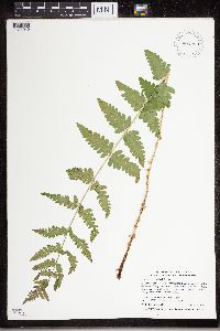 Dryopteris cristata (L.) A. Gray 907250[1324049]Smith, Welby 308862008-06-12 United States, Minnesota, Benton, Sartell Wildlife Management Area. Benton County...Sartell State Wildlife Management Area, about 5 miles southeast of Royalton...along Little Rock Creek...T 38N R 31W NW1/4 of SW1/4 of Sec 15. 038N 31W 15, 45.7838889 -94.1927778 |
MIN:Plants | 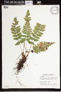 Dryopteris cristata (L.) A. Gray 914964[1324018]Smith, Welby 313222009-06-29 United States, Minnesota, Cook, Cook County...Boundary Waters Canoe Area Wilderness, Superior National Forest...T 63N R 3W NE1/4 of SE1/4 of Sec 6;Boundary Waters Canoe Area Wilderness / Superior National Forest;063N;03W;06, 47.9647222 -90.7486111 |
MIN:Plants | 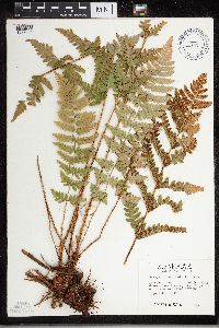 Dryopteris cristata (L.) A. Gray 508147[1327906]Kaul, R. 26941982-08-16 United States, Minnesota, Clearwater, Clearwater Co.; mouth of Boutwell [sic] Creek, Lake Itasca;Itasca State Park;143N;36W;, 47.197458 -95.201964 |
MIN:Plants | 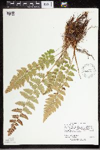 Dryopteris cristata (L.) A. Gray 507602[1327909]Lee, Michael MDL22371998-07-08 United States, Minnesota, Carver, Carver County ... Marsh Lake Hunting Club 2-1/2 miles south of Victoria ... T116N R24W SE1/4 of SE1/4 Sec. 26;;116N;24W;26, 44.821747 -93.664896 |
MIN:Plants | 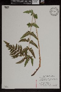 Dryopteris cristata (L.) A. Gray 915084[1305867]Smith, Welby 314382009-08-30 United States, Minnesota, Cook, Boundary Waters Canoe Area Wilderness / Superior National Forest. Cook County...Boundary Waters Canoe Area Wilderness, Superior National Forest. Just south of Grassy Lake...T63N R3W NE1/4 of SE1/4 of Sec 2. 063N 03W 2, 47.9655556 -90.6611111 |
MIN:Plants | 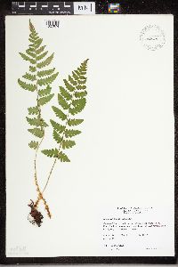 Dryopteris cristata (L.) A. Gray 492515[1327974]Wheeler, Gerald 159921997-06-08 United States, Minnesota, Nicollet, Swan Lake Wildlife Management Area. Nicollet County ... Ca. 4 mi. SSW of Nicollet on Rte. 23; Swan Lake State WMA, North Star Unit ... NW1/4 NW1/4 NE1/4 Sec, 28 T109N R28W. 109N 28W 28, 44.217999 -94.200153 |
MIN:Plants | 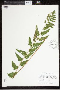 Dryopteris cristata (L.) A. Gray 909276[1324023]Smith, Welby 311682008-08-19 United States, Minnesota, Beltrami, Big Bog State Park. Beltrami County ... Big Bog State Recreation Area, about 9 miles north of Waskish on Highway 72 ... T156N R31W NE1/4 of SW1/4 of Sec 36. 156N 31W 36, 48.2844444 -94.5683333 |
MIN:Plants | 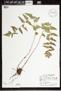 Dryopteris cristata (L.) A. Gray 904523[1324048]Smith, Welby 283061999-09-10 United States, Minnesota, Pine, Pine County...Banning State Park, about 3 miles SW of Askov...Kettle River...T43N R20W NE1/4 of SW1/4 of Sec 35;Banning State Park;043N;20W;35, 46.1630556 -92.8383333 |
MIN:Plants | 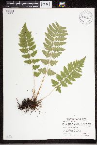 Dryopteris cristata (L.) A. Gray 905281[1324078]Smith, Welby 282321999-08-31 United States, Minnesota, Itasca, Itasca County...About 10 miles south of Nashwauk...T55N R22W NW1/4 of NW1/4 of Sec 29;;055N;22W;29, 47.2241667 -93.1658333 |
MIN:Plants | 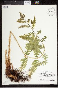 Dryopteris cristata (L.) A. Gray 499845[1324100]Harris, Fred 960171996-05-23 United States, Minnesota, Le Sueur, Le Sueur County ... Ney Environmental Learning Center ... small ravine on east edge of Minnesota River valley ... T 112N R 25W SW1/4 of SE1/4 of sec 6. 112N 25W 6, 44.535994 -93.878951 |
MIN:Plants | 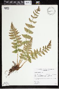 Dryopteris cristata (L.) A. Gray 461272[1327923]Gerdes, Lynden 27461998-06-18 United States, Minnesota, Cook, Superior National Forest. T65N R02W S27SESW. Cook County; Superior National Forest. ENE from the NE corner of Mayhew Lake, approx. 0.4 miles NE of the Gunflint Trail (Cty. 12) on FR 317.. 065N 02W 27, 48.084674 -90.565752 |
MIN:Plants | 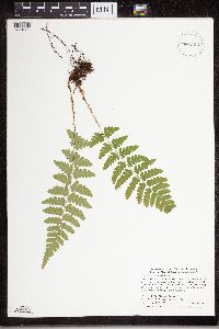 Dryopteris cristata (L.) A. Gray 907257[1324050]Smith, Welby 285752000-06-16 United States, Minnesota, Marshall, Thief Lake Wildlife Management Area. Marshall County...Thief Lake State Wildlife Management Area; about 5 miles NE of Gatzke...T 158 R 39W NW1/4 of SW1/4 of Sec 19. 158N 39W 19, 48.4877778 -95.7297222 |
MIN:Plants | 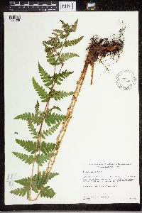 Dryopteris cristata (L.) A. Gray 431646[1324228]Gerdes, Lynden 35071999-06-25 United States, Minnesota, Cook, Superior National Forest. T65N R02W S17SESW. Cook County...Superior National Forest. Wetland adjacent to stream entering the northeastern most bay of Gunflint Lake. Approximately .25 mile south of Canadian border.. 065N 02W 17, 48.11124 -90.609239 |
MIN:Plants | 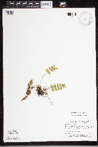 Dryopteris cristata (L.) A. Gray 519596[1324054]Myhre, K. 17061992-05-07 United States, Minnesota, Cass, Cass County...N side of Little Thunder Lake, 1 mile NE of Thunder Lake...T140N R26W SW1/4 of SW1/4 of Sec 2;;140N;26W;02, 46.964752 -93.940436 |
MIN:Plants | 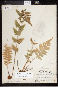 Dryopteris cristata (L.) A. Gray 275790[1327937]Grant, Martin 29361929-07-27 United States, Minnesota, Clearwater, Itasca Park. Clearwater Co, NE of campus [Univ. of Minn. Biol. Sta.]; NW-SW-1 T143 R36;Itasca State Park;143N;36W;1, 47.232294 -95.180237 |
MIN:Plants | 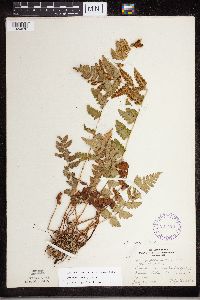 Dryopteris cristata (L.) A. Gray 293120[1324076]Lakela, Olga 10811934-07-26 United States, Minnesota, Saint Louis, John Kilpela's Farm, Palo, St. Louis Co.;;057N;15W;, 47.5833 -92.5 |
MIN:Plants | 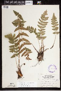 Dryopteris cristata (L.) A. Gray 336435[1324073]Lakela, Olga 18841936-09-26 United States, Minnesota, Saint Louis, Sec.19, Duluth;;N;;, 46.7833 -92.1 |
MIN:Plants | 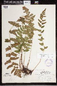 Dryopteris cristata (L.) A. Gray 337088[1324038]Lakela, Olga 18171936-08-31 United States, Minnesota, Saint Louis, Sec. 19. Duluth [other collections indicates this is in T49N R13W, Minnesota Point];Minnesota Point;049N;13W;19, 46.7833 -92.1 |
MIN:Plants | 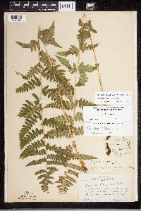 Dryopteris cristata (L.) A. Gray 338331[1324064]Rosendahl, C. 38471919-08-03 United States, Minnesota, Houston, 2 mi SW from Spring Grove, Houston Co.;;101N;07W;, 43.540592 -91.664248 |
MIN:Plants | 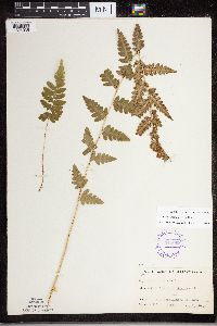 Dryopteris cristata (L.) A. Gray 348008[1324035]Buell, Murray 7091933-08-03 United States, Minnesota, Anoka, Decodon Pond, Anoka Co.;Cedar Creek National History Area;034N;23W;, 45.40217 -93.199397 |
MIN:Plants | 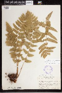 Dryopteris cristata (L.) A. Gray 351862[1324084]Nielsen, E. 17701932-10-10 United States, Minnesota, Anoka, 1/2 mi E of Bunker Lake - Bunker Prairie area E of Anoka village;Bunker Hills County Park;033N;24W;, 45.219109 -93.275651 |
MIN:Plants | 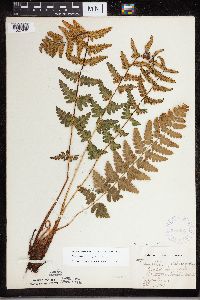 Dryopteris cristata (L.) A. Gray 354385[1327930]Barrows, Vera 741939-07-09 United States, Minnesota, Saint Louis, Old street car tracks to Eveleth; Virginia.;;N;;, 47.52326 -92.536571 |
MIN:Plants | 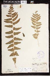 Dryopteris cristata (L.) A. Gray 355796[1324039]Cathcart, E. 1041875-00-00 United States, Minnesota, Hennepin, Lake Harriet;;N;;, 44.921821 -93.304866 |
MIN:Plants | 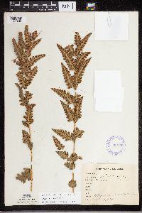 Dryopteris cristata (L.) A. Gray 358135[1327940]unknown 1211912-09-04 United States, Minnesota, Saint Louis, Meadowlands;;053N;19W;, 47.071884 -92.732416 |
MIN:Plants | 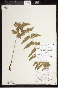 Dryopteris cristata (L.) A. Gray 358145[1324234]Rosendahl, C. 23201909-07-30 United States, Minnesota, Houston, Spring Grove, Houston Co.;;101N;07W;, 43.543165 -91.672028 |
MIN:Plants | 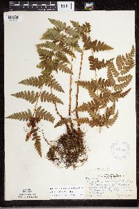 Dryopteris cristata (L.) A. Gray 362649[1324040]Butters, F.K. 135881940-09-18 United States, Minnesota, Chisago, 3 mi N of Taylors Falls, Chisago Co.;;N;;, 45.445347 -92.652429 |
MIN:Plants | 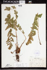 Dryopteris cristata (L.) A. Gray 380337[1327939]Lakela, Olga 53911943-08-11 United States, Minnesota, Saint Louis, Anna Kilpela's farm, Palo, St. Louis Co.;;057N;15W;, 47.415205 -92.259625 |
MIN:Plants | 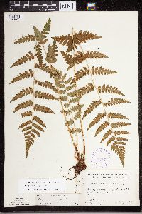 Dryopteris cristata (L.) A. Gray 387566[1324086]Moore, John 180931945-08-02 United States, Minnesota, Pine, Pine Co. 1/2 mi S of Danbury rd.;Saint Croix State Park;N;;, 45.966876 -92.58353 |
MIN:Plants | 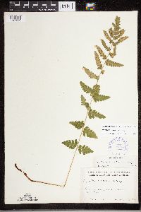 Dryopteris cristata (L.) A. Gray 387567[1327999]Schuster, R. s.n.1947-07-00 United States, Minnesota, Clearwater, Clearwater Co. Iron Springs, N of Itasca State Park;Iron Springs Bog Scientific Natural Area;144N;36W;, 47.275091 -95.222472 |
MIN:Plants | 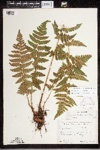 Dryopteris cristata (L.) A. Gray 387568[1324236]Moore, John 179351945-07-24 United States, Minnesota, Morrison, Morrison Co. 1 mi S of Cushing;;131N;31W;, 46.007122 -94.278687 |
MIN:Plants | 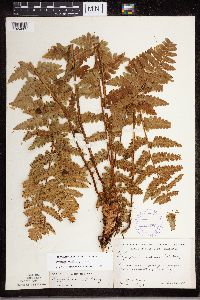 Dryopteris cristata (L.) A. Gray 387569[1324085]Moore, John 183281945-10-05 United States, Minnesota, Pine, Pine Co. 3 mi W of Pine City;;N;;, 45.82605 -93.030877 |
MIN:Plants | 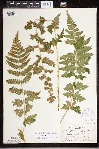 Dryopteris cristata (L.) A. Gray 387570[1327988]Huff, N. s.n.1941-07-08 United States, Minnesota, Sherburne, Zimmerman;;N;;, 45.443299 -93.589962 |
MIN:Plants | 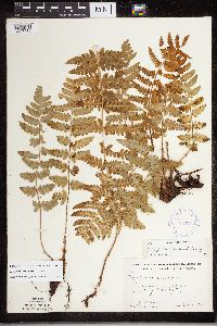 Dryopteris cristata (L.) A. Gray 387571[1327986]Moore, John 183901945-10-16 United States, Minnesota, Stearns, Stearns Co. 1/2 mi S of Cold Springs;;123N;30W;, 45.448557 -94.428885 |
MIN:Plants | 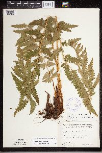 Dryopteris cristata (L.) A. Gray 387572[1324102]Moore, John 174921945-06-29 United States, Minnesota, Kanabec, Kanabec Co. 7 mi SE of Mora;;;;, 45.805189 -93.190895 |
MIN:Plants | 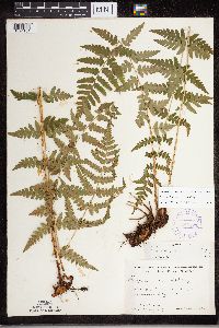 Dryopteris cristata (L.) A. Gray 387573[1324101]Moore, John 175161945-06-29 United States, Minnesota, Isanti, Isanti Co. 4 mi S of Braham;;037N;23W;, 45.664821 -93.170776 |
MIN:Plants | 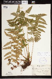 Dryopteris cristata (L.) A. Gray 387574[1327998]Butters, F.K. 1451938-07-13 United States, Minnesota, Cook, Between Mountain Lake and Pike Lake.;Boundary Waters Canoe Area Wilderness / Superior National Forest;065N;02E;, 47.765692 -90.591554 |
MIN:Plants | 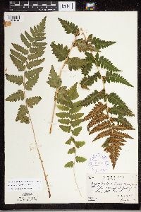 Dryopteris cristata (L.) A. Gray 387575[1324044]Butters, F.K. 8541944-08-02 United States, Minnesota, Cook, Cook Co. At foot of Lima Mt. Trail, T64N, R1W;Superior National Forest;064N;01W;, 47.726653 -90.386005 |
MIN:Plants | 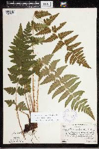 Dryopteris cristata (L.) A. Gray 387576[1327935]Butters, F.K. 8971944-08-04 United States, Minnesota, Cook, Cook Co. Along the Gunflint Trail about 2 mi W of the Cross River, T65N R4W;Superior National Forest;065N;04W;, 48.113086 -90.82588 |
MIN:Plants | 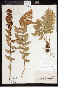 Dryopteris cristata (L.) A. Gray 407365[1327927]Lakela, Olga 99151949-09-17 United States, Minnesota, Saint Louis, Rd to S boundary, from Prairie Lake, SW St. Louis Co.;;050N;20W;, 46.7833 -92.9 |
MIN:Plants | 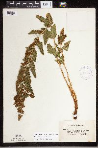 Dryopteris cristata (L.) A. Gray 407415[1327983]Lakela, Olga 93921949-08-14 United States, Minnesota, Saint Louis, At Fredenberg Lake, St. Louis Co.;;N;;, 46.987037 -92.191099 |
MIN:Plants | 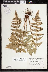 Dryopteris cristata (L.) A. Gray 412471[1327945]Moore, John 113951939-08-02 United States, Minnesota, Roseau, W side of road, 1.3 mi N of Longworth;Roseau River Wildlife Management Area;164N;37W;, 48.895607 -95.727488, 327m |
MIN:Plants | 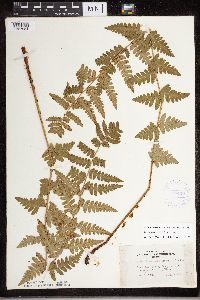 Dryopteris cristata (L.) A. Gray 419978[1327984]Lakela, Olga 122821950-10-07 United States, Minnesota, Saint Louis, Henry Lakela's farm. St. Louis Co. Palo;;057N;15W;, 47.583299 -92.48927 |
MIN:Plants | 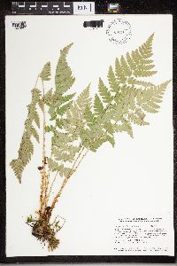 Dryopteris cristata (L.) A. Gray 429999[1327989]Smith, Welby 129801987-06-16 United States, Minnesota, Washington, Washington Co.; On the east side of Highway 4, about 1/2 mile northwest of Marine on St. Croix; about 150 feet above the Washington Co.; On the east side of Highway 4, about 1/2 mile northwest of Marine on St. Croix; about 150 feet above the floodplain of the St. Croix River; SW1/4 NE1/4 section 1, T 31N R 20W. 031N 20W 1, 45.2061119 -92.7797241 |
MIN:Plants | 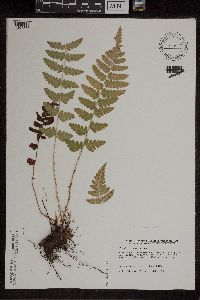 Dryopteris cristata (L.) A. Gray 440115[1305876]Harris, Fred 931891993-09-01 United States, Minnesota, Polk, Polk Co. Lessor WMA; SE1/4 of NW1/4 Sec 2 T149N R41W;Lessor Wildlife Management Area;149N;41W;2, 47.75362 -95.869592 |
MIN:Plants | 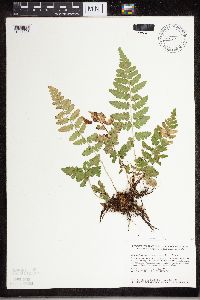 Dryopteris cristata (L.) A. Gray 440702[1327993]Smith, Welby 148601988-08-12 United States, Minnesota, Washington, Belwin Outdoor Education Laboratory. Washington Co. Belwin Outdoor Education Laboratory, about 1/2 mi W of St. Mary's Point. Bog (Trails End Marsh); NE1/4 NE1/4 sec.15, T28N R20W. 028N 20W 15, 44.9213889 -92.7833333 |
MIN:Plants | 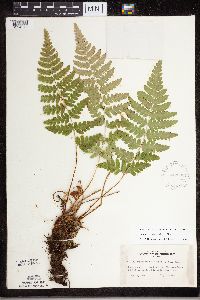 Dryopteris cristata (L.) A. Gray 442582[1324079]Lakela, Olga 130021951-07-10 United States, Minnesota, Saint Louis, Namakan Lake, at Kettle Falls, St. Louis Co.;Voyageurs National Park;070N;18W;, 48.49944 -92.63889 |
MIN:Plants | 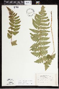 Dryopteris cristata (L.) A. Gray 443206[1327926]Lakela, Olga 138201951-09-14 United States, Minnesota, Saint Louis, Echo Lake, on Crane Lake Road, N St. Louis Co.;Superior National Forest;066N;17W;, 48.2833 -92.4667 |
MIN:Plants | 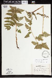 Dryopteris cristata (L.) A. Gray 443338[1327931]Lakela, Olga 126651951-06-25 United States, Minnesota, Saint Louis, Hwy. 1, about 6 mi SW of Ely, St. Louis Co.;;N;;, 47.583299 -92.48927 |
MIN:Plants | 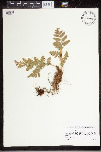 Dryopteris cristata (L.) A. Gray 444546[1324118]Sather, Nancy s.n.1995-08-18 United States, Minnesota, Mahnomen, Mahnomen Co.; east of Jessie Lake; T143 R40 NE of Sec 27;White Earth Indian Reservation / White Earth State Forest;143N;40W;27, 47.167799 -95.738926 |
MIN:Plants | 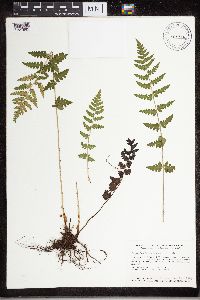 Dryopteris cristata (L.) A. Gray 453472[1327992]Smith, Welby 131081987-06-24 United States, Minnesota, Pine, Saint Croix State Park. Pine County...St. Croix State Park; perched about 70 feet above the floodplain of the St. Croix River...NE1/4 SW1/4 section 31, T 41N R 17W. 041N 17W 31, 45.9897222 -92.5436111 |
MIN:Plants | 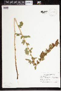 Dryopteris cristata (L.) A. Gray 457076[1324055]Smith, Welby 212171992-08-04 United States, Minnesota, Hennepin, Hennepin Co.; about 1.5 miles southeast of Chanhassen; T 116N R 22W NW1/4 of NE1/4 of Sec19 Hennepin Co.; about 1.5 miles southeast of Chanhassen; T 116N R 22W NW1/4 of NE1/4 of Sec 19. 116N 22W 19, 44.8463898 -93.5077744 |
MIN:Plants | 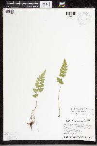 Dryopteris cristata (L.) A. Gray 459132[1324034]Smith, Welby 130951987-06-19 United States, Minnesota, Washington, Washington Co.; about 7 miles W of Marine on St. Croix; NW1/4 NE1/4 sec.2, T31N R21W;;031N;21W;2, 45.207222 -92.9238892 |
MIN:Plants | 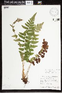 Dryopteris cristata (L.) A. Gray 459137[1324033]Smith, Welby 130581987-06-18 United States, Minnesota, Pine, Pine County... in the St. Croix River Valley, about 7 miles SE of Pine City...about 70 ft above the floodplain; NE1/4 NE1/4 sec.21, T38N R20W. 038N 20W 21, 45.7722222 -92.8411111 |
MIN:Plants | 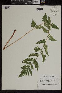 Dryopteris cristata (L.) A. Gray 460538[1305874]Smith, Welby 206851992-07-07 United States, Minnesota, Winona, Dorer Memorial Hardwood State Forest. Winona Co.; About 2.5 miles east-northeast of Lewiston; overlooking Garvin Brook; T106N R9W SE1/4 of SW1/4 of Sec 8 Winona Co.; About 2.5 miles east-northeast of Lewiston; overlooking Garvin Brook; T 106N R 9W SE1/4 of SW1/4 of Sec 8. 106N 08W 8, 43.9936104 -91.8125 |
MIN:Plants | 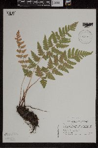 Dryopteris cristata (L.) A. Gray 485107[1305875]Smith, Welby 194231991-07-10 United States, Minnesota, Koochiching, Koochiching State Forest. Koochiching Co.; on the N side of Moose Lake, about 6 miles E of Little Fork; T68N R24W Koochiching Co.; on the N side of Moose Lake, about 6 miles E of Little Fork; T68N R24W SE1/4 of SE1/4 of sec 9. 068N 24W 9, 48.3922234 -93.4236145 |
MIN:Plants | 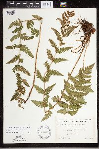 Dryopteris cristata (L.) A. Gray 491677[1327987]Lakela, Olga 169901953-09-03 United States, Minnesota, Saint Louis, St. Louis County...Trout Lake portage from Vermilion Lake;Boundary Waters Canoe Area Wilderness / Superior National Forest;063N;16W;24, 47.92435 -92.31937 |
MIN:Plants | 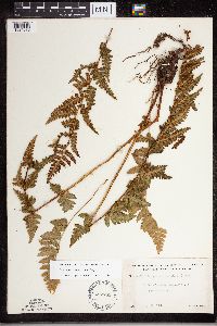 Dryopteris cristata (L.) A. Gray 492785[1324070]Lakela, Olga 169011953-08-25 United States, Minnesota, Saint Louis, St. Louis Co. Hwy. #5, N of Toivola;;N;;, 47.166882 -92.811028 |
MIN:Plants | 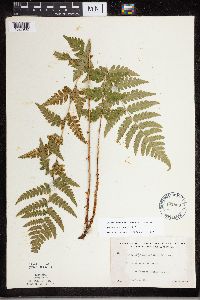 Dryopteris cristata (L.) A. Gray 492859[1327932]Lakela, Olga 162461953-07-19 United States, Minnesota, Saint Louis, St. Louis Co. Vermilion Lake at Treasure Island Resort.;;N;;, 48.2667 -92.4 |
MIN:Plants | 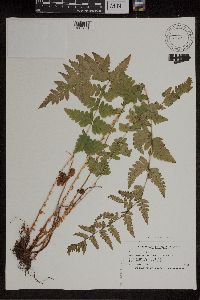 Dryopteris cristata (L.) A. Gray 508239[1305871]Smith, Welby 187281991-06-07 United States, Minnesota, Todd, Todd Co.; about 3.5 mi SW of Motley; T133N R32W NW1/4 of NE1/4 of Sec 27;;133N;32W;27, 46.3088875 -94.7011108 |
MIN:Plants | 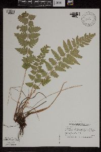 Dryopteris cristata (L.) A. Gray 508276[1305868]Smith, Welby 186331991-06-05 United States, Minnesota, Kandiyohi, Kandiyohi Co.; about 11 mi N of Wilmar, and 1 mi S of Andrew Lake; T121N R35W SE1/4 of SE1/4 of Sec 14;;121N;35W;14, 45.2852783 -95.0322189 |
MIN:Plants | 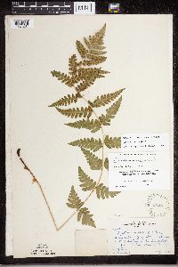 Dryopteris cristata (L.) A. Gray 52110[1324237]Butters, F.K. 39601920-07-01 United States, Minnesota, Houston, S of dwelling on the Rosendahl Farm, Spring Grove, Houston Co.;;101N;07W;, 43.56108 -91.635979 |
MIN:Plants | 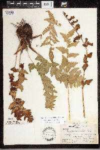 Dryopteris cristata (L.) A. Gray 52111[1324047]Butters, F.K. 35751918-07-08 United States, Minnesota, Crow Wing, 4-5 mi E of Hubert, Crow Wing Co.;;;;, 46.358005 -94.137895 |
MIN:Plants | 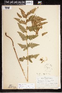 Dryopteris cristata (L.) A. Gray 52112[1324098]Rosendahl, C. 37621918-08-27 United States, Minnesota, Clearwater, Floating Bog Bay, Itasca Park;Itasca State Park;143N;36W;, 47.197458 -95.201964 |
MIN:Plants | 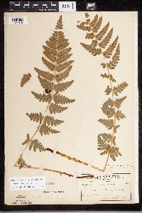 Dryopteris cristata (L.) A. Gray 52113[1327919]Taylor, B. s.n.1892-07-00 United States, Minnesota, Chisago, Center City;;N;;, 45.389814 -92.821151 |
MIN:Plants | 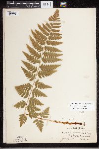 Dryopteris cristata (L.) A. Gray 52114[1327948]Lyon, H. 7991903-07-18 United States, Minnesota, Hennepin, Deephaven;;N;;, 44.928253 -93.524063 |
MIN:Plants | 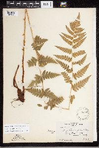 Dryopteris cristata (L.) A. Gray 52115[1327947]Rosendahl, C. 22201909-07-06 United States, Minnesota, Hennepin, Purgatory Swamp, Hennepin Co.;;N;;, 44.929685 -93.522455 |
MIN:Plants | 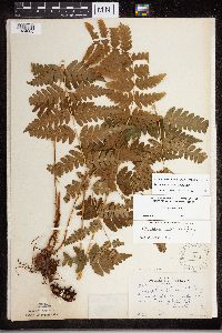 Dryopteris cristata (L.) A. Gray 52117[1324065]Rosendahl, C. 13081903-08-07 United States, Minnesota, Houston, Sec.22, Spring Grove Twp, Houston Co.;;101N;07W;22, 43.536819 -91.660784 |
MIN:Plants | 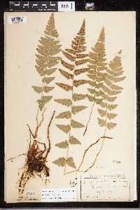 Dryopteris cristata (L.) A. Gray 52120[1327918]Butters, F. 1111901-08-08 United States, Minnesota, Becker, Detroit, Becker Co.;;N;;, 46.817181 -95.845325 |
MIN:Plants | 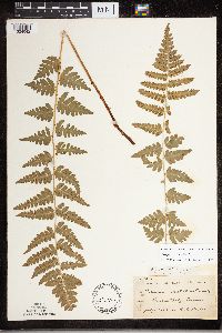 Dryopteris cristata (L.) A. Gray 52121[1324042]Taylor, B. T14641892-07-00 United States, Minnesota, Chisago, Center City;;N;;, 45.389814 -92.821151 |
MIN:Plants | 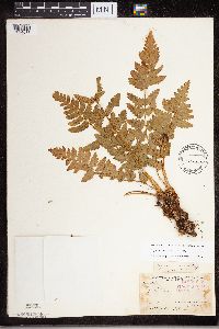 Dryopteris cristata (L.) A. Gray 52122[1324077]Arthur, J. B3531886-07-24 United States, Minnesota, Saint Louis, Mud River, Vermilion Lake;;062N;14W;07, 48.492574 -92.768553 |
MIN:Plants | 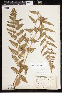 Dryopteris cristata (L.) A. Gray 52123[1327917]Ballard, C. B1481891-06-00 United States, Minnesota, Carver, Chaska;;N;;, 44.789407 -93.602179 |
MIN:Plants | 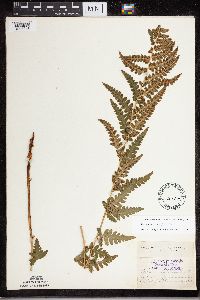 Dryopteris cristata (L.) A. Gray 52124[1327946]Aiton, G. s.n.1892-07-00 United States, Minnesota, Rice, Rice Co.;;N;;, 44.35 -93.3333 |
MIN:Plants | 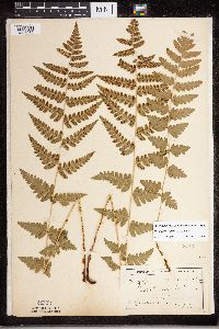 Dryopteris cristata (L.) A. Gray 52125[1324036]Butters, F. 111a1901-08-08 United States, Minnesota, Becker, Detroit, Becker Co.;;N;;, 46.817181 -95.845325 |
MIN:Plants | 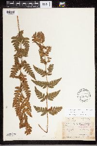 Dryopteris cristata (L.) A. Gray 52126[1327943]Arthur, J. 155A1886-07-00 United States, Minnesota, Saint Louis, Vermilion Lake;;;;, 47.89167 -92.36667 |
MIN:Plants | 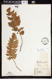 Dryopteris cristata (L.) A. Gray 52127[1327941]Moyer, Lycurgus s.n.1915-10-21 United States, Minnesota, Saint Louis, Iron range, Virginia;;N;;, 47.52326 -92.536571 |
MIN:Plants | 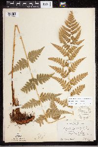 Dryopteris cristata (L.) A. Gray 52150[1327920]Rosendahl, C. s.n.1909-07-06 United States, Minnesota, Hennepin, Purgatory Swamp, Hennepin County;;117N;22W;00, 44.929685 -93.522455 |
MIN:Plants | 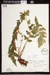 Dryopteris cristata (L.) A. Gray 525940[1324037]Lakela, Olga 191601955-08-09 United States, Minnesota, Saint Louis, St. Louis Co. Small lake, Jack Lakela Farm, Palo;;057N;15W;, 47.415205 -92.259625 |
MIN:Plants | 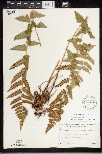 Dryopteris cristata (L.) A. Gray 526680[1327944]Lakela, Olga 182061954-08-14 United States, Minnesota, Saint Louis, St. Louis Co. Off Pappoose Lake, near St. Louis Co. line;;N;;, 48.146335 -91.849218 |
MIN:Plants | 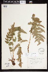 Dryopteris cristata (L.) A. Gray 526982[1327929]Lakela, Olga 177561954-07-03 United States, Minnesota, Saint Louis, St. Louis Co. Dark Lake S of Curtain Falls.;Boundary Waters Canoe Area Wilderness / Superior National Forest;066N;12W;, 48.211941 -91.965085 |
MIN:Plants | 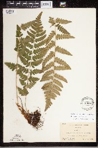 Dryopteris cristata (L.) A. Gray 536180[1324099]Wherry, E. 33661935-06-26 United States, Minnesota, Anoka, Anoka Co. Rice Lake;Rice Creek Chain of Lakes County Park;031N;22W;, 45.128065 -93.150423 |
MIN:Plants | 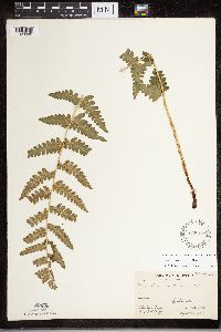 Dryopteris cristata (L.) A. Gray 538919[1328000]Briggs, John De Q. 1231945-08-00 United States, Minnesota, Cook, Cook Co. Sawbill Lake. T62N, R4W;Superior National Forest;062N;04W;, 47.88583 -90.87778 |
MIN:Plants | 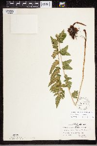 Dryopteris cristata (L.) A. Gray 543405[1324060]Lakela, Olga 217121957-07-26 United States, Minnesota, Lake, Tomahawk Trail W of Isabella Lake, Lake Co.;Boundary Waters Canoe Area Wilderness / Superior National Forest;062N;08W;35, 47.583104 -91.421915 |
MIN:Plants | 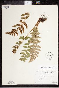 Dryopteris cristata (L.) A. Gray 543461[1324075]Lakela, Olga 207431956-08-09 United States, Minnesota, Saint Louis, St. Louis County...along portage between Gun and Bullet Lakes, N of Ely, Superior National Forest;Boundary Waters Canoe Area Wilderness / Superior National Forest;065N;12W;12, 48.030785 -92.058533 |
MIN:Plants | 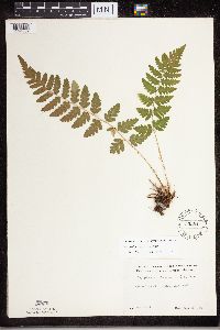 Dryopteris cristata (L.) A. Gray 552547[1324067]Partch, M. s.n.1958-08-10 United States, Minnesota, Mahnomen, Mahnomen Co. Oakland Twp, Balsam Beach;White Earth Indian Reservation;143N;40W;, 47.321111 -95.966111 |
MIN:Plants | 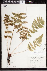 Dryopteris cristata (L.) A. Gray 568974[1324089]Moore, John 253261960-10-06 United States, Minnesota, Rice, 1/2 mi S of Shields Lake;;110N;22W;, 44.362804 -93.441437 |
MIN:Plants | 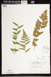 Dryopteris cristata (L.) A. Gray 570364[1324046]Worcester, H. s.n.1961-09-28 United States, Minnesota, Aitkin, Aitkin Co, Sandy River, about 3 mi NW of the town of McGregor;;048N;24W;, 46.639485 -93.359657 |
Google Map
Google Maps is a web mapping service provided by Google that features a map that users can pan (by dragging the mouse) and zoom (by using the mouse wheel). Collection points are displayed as colored markers that when clicked on, displays the full information for that collection. When multiple species are queried (separated by semi-colons), different colored markers denote each individual species.